Back مقاطعة كيب غيراردو (ميزوري) Arabic Cape Girardeau County, Missouri BAR Кейп Жирардо (окръг, Мисури) Bulgarian কেপ গিরারদিউ কাউন্টি, মিসৌরি BPY Cape Girardeau Gông (Missouri) CDO Кейп-Жирардо (гуо, Миссури) CE Cape Girardeau County CEB Cape Girardeau County, Missouri Welsh Cape Girardeau County German Condado de Cape Girardeau Spanish
Cape Girardeau County | |
|---|---|
 Cape Girardeau County Courthouse in Jackson | |
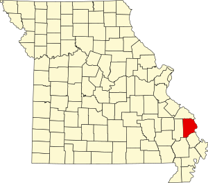
 Location within the U.S. state of Missouri | |
 Missouri's location within the U.S. | |
| Coordinates: 37°23′N 89°41′W / 37.38°N 89.68°W | |
| Country | |
| State | |
| Founded | October 1, 1812 |
| Named for | A rock promontory over the Mississippi River and Ensign Sieur Jean Baptiste de Girardot (also spelled Girardeau or Girardat) |
| Seat | Jackson |
| Largest city | Cape Girardeau |
| Area | |
| • Total | 586 sq mi (1,520 km2) |
| • Land | 579 sq mi (1,500 km2) |
| • Water | 7.8 sq mi (20 km2) |
| Population (2020) | |
| • Total | 81,710 |
| • Density | 140/sq mi (54/km2) |
| Time zone | UTC−6 (Central) |
| • Summer (DST) | UTC−5 (CDT) |
| Congressional district | 8th |
| Website | www |
Cape Girardeau County is located in the southeastern part of the U.S. state of Missouri; its eastern border is formed by the Mississippi River. At the 2020 census, the population was 81,710.[1] The county seat is Jackson,[2] the first city in the US to be named in honor of President Andrew Jackson. Officially organized on October 1, 1812, the county is named after Ensign Sieur Jean Baptiste de Girardot, an official of the French colonial years. The "cape" in the county's name is named after a former promontory rock overlooking the Mississippi River; this feature was demolished during railroad construction. Cape Girardeau County is the hub of the Cape Girardeau–Jackson metropolitan area. Its largest city is Cape Girardeau.
- ^ "2020 Population and Housing State Data". United States Census Bureau. Retrieved September 3, 2021.
- ^ "Find a County". National Association of Counties. Archived from the original on May 31, 2011. Retrieved June 7, 2011.
© MMXXIII Rich X Search. We shall prevail. All rights reserved. Rich X Search