Back حوض البحيرات العظمى Arabic Büyük Göller Havzası Turkish Водозбірний басейн Великих озер Ukrainian

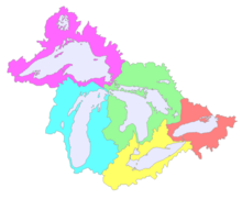
The Great Lakes Basin consists of the Great Lakes and the surrounding lands of the states of Illinois, Indiana, Michigan, Minnesota, New York, Ohio, Pennsylvania, and Wisconsin in the United States, and the province of Ontario in Canada, whose direct surface runoff and watersheds form a large drainage basin that feeds into the lakes. It is generally considered to also include a small area around and beyond Wolfe Island, Ontario, at the east end of Lake Ontario, which does not directly drain into the Great Lakes, but into the Saint Lawrence River.
The Basin is at the center of the Great Lakes region.
© MMXXIII Rich X Search. We shall prevail. All rights reserved. Rich X Search