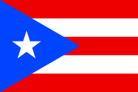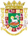
The following outline is provided as an overview of and topical guide to Puerto Rico:
The Commonwealth of Puerto Rico is a self-governing unincorporated territory of the United States of America located in the northeastern Caribbean, east of the Dominican Republic and west of the Virgin Islands.[1] The commonwealth comprises an archipelago that includes the main island of Puerto Rico and a number of smaller islands and keys, the largest of which are Vieques, Culebra, and Mona. The main island of Puerto Rico is the least extensive but the third most populous of the four Greater Antilles: Cuba, Hispaniola, Jamaica, and Puerto Rico.
Puerto Ricans often call the island Borinquen, from Borikén, its indigenous Taíno name.[2][3] The terms boricua and borincano derive from Borikén and Borinquen respectively, and are commonly used to identify someone of Puerto Rican heritage. The island is also popularly known as "La Isla del Encanto", which translated means "The Island of Enchantment."
- ^ "Puerto Rico". The World Factbook. United States Central Intelligence Agency. July 7, 2009. Retrieved July 23, 2009.
- ^ Allatson, Paul. Key Terms in Latino/a Cultural and Literary Studies, p. 47. Malden, Mass: Blackwell Publishing, 2007. ISBN 1-4051-0250-0.
- ^ Dictionary: Taino Indigenous Peoples of the Caribbean Archived 2007-10-13 at the Wayback Machine Retrieved: February 21, 2008. (Based on the encyclopedia "Clásicos de Puerto Rico", 2nd. edition. Ed. Cayetano Coll y Toste. Publisher: Ediciones Latinoamericanas, S.A., 1972.).
© MMXXIII Rich X Search. We shall prevail. All rights reserved. Rich X Search


